send link to app

My Altitude app for iPhone and iPad


4.6 ( 8736 ratings )
Travel Navigation
Developer: Dayana Networks Ltd
Free
Current version: 2.8.3, last update: 1 year ago
First release : 21 Sep 2011
App size: 64.08 Mb

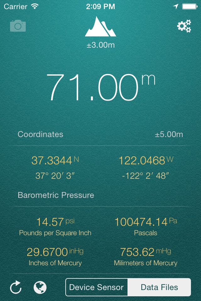
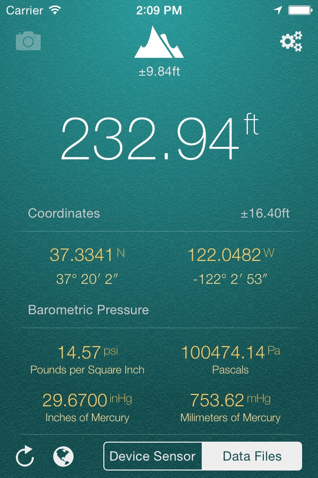
My Altitude uses GPS signals to determine your current location, showing your latitude, longitude and altitude (height from sea level) barometric pressure and water boiling point.

Its a free app and does not have any limitations. In-App purchase can be used to remove the bottom advertisement and to support us.

This application does not need an internet connection and works best in outdoors.

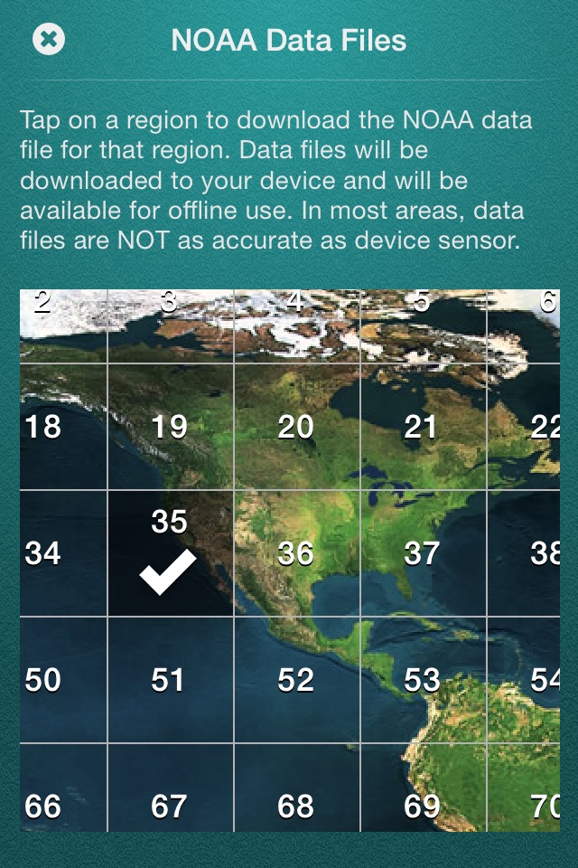
By default, it uses device sensor to determine the elevation from see level, but you also have the option to use NOAA data files to get the altitude of your location. On newer devices, using device sensor is more accurate.

It also allows you to get a picture of where you are and save it in photo album. Picture will be sealed with coordinates of current location along with altitude and local date/time.

Barometric Pressure is calculated based on elevation. On newer devices such as iPhone 6/6+ value is being delivered directly from device built-in barometric sensor, this behavior is configurable and you can switch back to calculation mode.

App Features:
- Elevation from see level in meter (metric) or feet (imperial)
- Change between metric and imperial systems by tapping on reported elevation
- Current location coordinates including latitude and longitude
- Barometric pressure in various units extracted from device sensor or calculated from altitude
- Water boiling point at your current location
- Current weather information including temperature, condition, humidity, wind speed and wind bearing
- World Altitude, get approximate altitude (elevation from see level) of any location in the world
- Save altitude data for reference
- Take a picture and watermark it with elevation information and share

Enjoy.

Pros and cons of My Altitude app for iPhone and iPad

My Altitude app good for

I like very much this application and I use for my work (collecting biological samples) every day. It is easy to use and very effective. Unfortunately I paid to remove the advertisement but does not work yet....
Excellent and useful app. Could be better if have had compass in it.
Have tested this app in many locations and found it to be very accurate at all of them. Thank you.
Works well. Loaded up fast and has the basic altitude information plus a few extras. No bling but very good and simple.
Its "My Altitude". Lucky to get coords, boiling point, and pressure. Thanks.
Highly recommended...I took it with me on my trip to Everest Base Camp in May 2012. Five stars if I could store the data with a date time stamp as a permanent record.

Some bad moments

I dont know why but the app is always searching satelites but the position is right , so no altitude
The Apple Watch shows only imperial, even if I choose metric in iPhone!
Photos dont autosave and altimeter can be off by couple hundred feet. And has huge useless margins of error.
The app doesnt have anything special. It has even lass than others.
I live ON the coast. The app says that My Altitude is 76 feet +/- 26 feet!! For the readers who dont understand .... the garage floor of my house (that I am currently standing on) is 30 feet above sea level. Therefore, the app SHOULD be reading (approx) 33 feet. +/- 26 feet ....... this app must have been developed for government work.
Perhaps I dont know how to use My Altitude but with Device Sencor mode I get a reading that is at least 100 feet high and it keeps changing. The Data Files mode reading is stable but off as well.

Usually My Altitude iOS app used & searched for

elevation app, info, my.location, my-location, and other. So, download free My Altitude .ipa to run this nice iOS application on iPhone and iPad.